Massachusetts Area Planning Council recently completed a report that looks at ridership of Lime bikes since they came into the market in 2018. There is a lot here and I’m not going to unpack all of it. I suggest reading it not only for the facts, but for how they use data-driven maps as part of the storytelling. It’s very interesting.
But a couple of interesting takeaways when it comes to Newton:
- Most rides stay in the city — 85% of riders start and end their ride within Newton. This isn’t true of every city on the list.
- Riders aren’t necessarily connecting to transit — While advocates hope that bikes can be a last-mile connection to transit, that’s now how they’re being used most often. These are mostly end-to-end trips that are, on average, 1.3 miles and lasting about 16 minutes. That distance happens to align with the same distance for most car trips. The suggestion here is that people will use bikes as a car replacement when possible.
- Most Lime users don’t have a bike — a recent survey of users found that 53% don’t have their own bike or hadn’t ridden one in a while.
- People ride on Washington and Needham — One map shows clearly the streets with the highest concentration of riders. Washington Street and Needham Street top the list, along with Walnut Street. In fact, Needham St. had significantly more riders than the Greenway. I would surmise that’s because you can actually get to retail on Needham Street, plus, that’s where the bikes are often lined up.
- Rides end in residential neighborhoods — This is no small issue, especially when you consider that the city is planning a move away from Lime and toward the docked BlueBikes. Lime saw a decline in usage when they moved from lower-priced pedal-only bikes to higher-cost electric assist. I have to imagine we’ll see a similar reduction in ridership when you add in the complication of walking to and from the limited number of docks.
Fixing “high stress” bike routes
 The thing that struck me the most was a map almost at the end of the report that shows where people ride, overlayed with high-stress routes. Washington Street, with its multiple lanes of car traffic and lack of bike lanes, qualifies as a high-stress street. I was surprised to see that the Newtonville to Newton Corner route had more riders than W. Newton to Newtonville. I wonder if that’s because of Whole Foods or some other draw.
Regardless, the map draws clear, bold, data-driven lines to tell the city “Build bike lanes here! It’s where people are riding!” It happens that at least Needham Street will soon have those accommodations.

Since buried in the report Lime-bike type trips in Newton are significantly LESS THAN 0.03% of all trips (that’s less than 3 per 10,000!!!) — WHY ARE WE EVEN TALKING ABOUT THIS???
OK, if the City wants to leave those bikes lying around littering the City for the (extremely) very occasional usage, sobeit.
But residents and taxpayers should demand there NEVER BE ONE CENT of City subsidy (as providers are apparently seeking) — to say nothing of the inherent safety risk and ensuing injury and death statistics, where not even helmets are enforced (IMHO any activity requiring a helmet and then mixing with motor vehicular traffic is inherently dangerous to the many less than optimally fit and skilled).
If the state MAPC wants to waste money here in Newton, sobeit, but that folly should NOT be extended to the local taxing authority.
Great analysis, Chuck.
Re: Needham St., remember that a previous administration worked with Needham to try and push MassDOT to build a much less bike-friendly design for Needham St. than the one we’re going to get. MassDOT forced us to accept the goodness that’s coming.
Thank you Chuck. I would add:
There are kids already biking on these high stress streets. Washington Street in particular because of it’s connection to Newton North. Lime isn’t recording these trips, they have their own bikes.
They are mostly forced onto the sidewalk, which is obviously worse for pedestrians, but also makes them far more vulnerable to drivers at intersections.
Build safe infrastructure for everyone, now.
P.S. Related, the Charles River Bike Path is both beautiful and heavily used. I want to see more focus from the Newton government on finishing the Blue Heron Riverside expansion through the missing Newton segment and into Wellesley.
The fascinating thing about the study is how it works as a sampling for what is otherwise difficult to track. To date, most tracking of bike rides happens through observation. You put some people on a street corner and count the bikes.
In this case we have GPS-enabled technology that offers a sample. Clearly these bikes are not as widely used in Newton as personal bikes, but it allows us to get a sense of trendlines, which allows us to then learn how to incentivize the behaviors we want.
One other thing of interest: Lime is owned by Uber and BlueBikes by Lyft. Yet, MAPC threw a bit of shade their way by noting how we have data because of the deal worked out with Lime. To date, neither of those companies have supplied data about their core services, which would help in creating better street plans, including establishing dropoff zones.
@Jim Epstein: One of the good reasons for talking about it is that the report includes analytics and data that are not ever analyzed for automobile traffic. Ideally, one would conclude something along the likes of “if only we could similarly and clearly understood how much of the automobile traffic on Washington and Needham Streets was for trips that never stop in Newton, we could better plan for and manage any congestion problems that might be causing.”
I am confident others have better questions about automobile traffic that they would like answered. Maybe getting some smart minds working on how to get the data would be good thing?
I often ride a Lime bike 3.5 miles from the Newton Highlands T stop to Needham, and unfortunately I get stuck risking my life on Needham Street and Highland Ave. because Needham has a mean-spirited, small-minded selectman who has done everything in his power to ensure that the Upper Falls Greenway doesn’t connect to Needham along the abandoned railroad tracks behind Staples and Muzi Ford. He’s one of the reasons (together with Brookline and Boston being out-of-network) that most Lime bikes rented in Newton never cross the city line.
Nothing against the lime bikes, but I travel Washington street, which I live 4 house from, at least 4 or 5 times a day. I can count on 1 hand the number of lime bikes I have seen.
In my late 20s and early 30s ( before kids ) I used to bike commute down to an office on western ave. I used to ride in the sidewalk all the way through Nonantum, where I would pick up the bike path in Watertown square.
Would a bike lane increase ridership? Probably some.
Also, the data on “Travel Routes and Road Stress” is suspect. The Lime app itself doesn’t accurately record the path traveled or even the distance.
For example I’m looking back at several dozen rides in the “My Rides” section of the app and most of the trips wee incorrectly recorded as being between 0 and 300 feet, when in fact I never took any trip of less than a mile. My app’s history contains a couple of pedal-bike trips last year that accurately recorded the origin and destination as well as the air distance between them, but it only shows a straight line between the two and not the actual route traveled.
So I have a hard time believing that the “waypoint” data in the study is somehow more accurate than the data recorded in the user’s own app.
That probably explains the alleged under-use of the Upper Falls Greenway, where I see Lime bikes all the time.
Overall I really hope that this data isn’t used to guide policy, because Lime riders are a very unique and irregular segment of travelers who really don’t tell you much about genuine travel patterns, and it also seems that the study’s “data cleaning” methodology used to generate hypothetical travel routes, while probably the most logical methodology, still ended up being seriously flawed due to the incompleteness of the underlying data.
This is interesting and good data to have and examine. I wouldn’t be so quick to exclude the data provided in this story – yes, data collection isn’t perfect, but you should be able to set or create thresholds for the data that you want to look at it, such as excluding trips of under half a mile, impossibly straight paths, etc.
Re: straight line between two points: same exact thing happened last week when my exercise app mapped my run as “jumping” from one point to another as the crow flies. But having run this route many times, the distance calculated was accurate for some reason, so go figure.
The story mentions the following – and I agree somewhat Michael, I don’t know if you can really extrapolate Lime riders to riders as a whole, but it’s worth exploring:
“Lime bike users are generally not frequent cyclists; according to recent user survey, 53 percent have not used their own bicycle in more than a month, or don’t even own one. If certain facilities are highly utilized by Lime bike riders, it is likely these same facilities will be very important to cyclists and would-be cyclists throughout the community. Moreover, their experience on the roadway while using a Lime bike may influence whether these interested but infrequent cyclists cycle more often; or if they are deterred by dangerous or unpleasant conditions. Therefore, the routes heavily used by Lime bike riders should be important priorities for local bike facility improvements.”
It would be SO GREAT if Google and Apple were able to release their closely guarded data on biking – that’d be so much more data to mine (but alas competitive advantages take precedence….)
What sort of bike mileage do our city councilors, city Design Department personnel, and city / V14 biking proponents put in ?
@blueprintbill I know that a few people in city hall, including at least one in the mayor’s office, ride regularly to work.
Some, however, are subject to the same housing issues that we discuss on this site over and over again. Because they come from distant locations, biking to work is impossible. The head of our planning department lives in Rhode Island. I’ve spoken with several employees who live in Somerville, making a bike commute difficult at best (though, I know at least one who does it).
I’ve also seen many cases in which the infrastructure holds back bike commuting. The daughter of a key member of Mass Bike lives in Needham and works in Newton, but the route over Kendrick Street (at the 128 ramps) is so dangerous for cyclists that she cannot safely bike the relatively short route to her job at Wells Ave. It’s the same issue mentioned by @michael above. I’ve biked on Highland Ave over 128 and it’s harrowing.
My takeaway from the report overall is the Lime data offers us an indication that people will bike given the chance and we can increase usage by providing better facilities. This gives us an opportunity to achieve our overall goal of reducing short car trips, thereby having a measurable impact on both traffic and pollution.
@Chuck Tanowitz
You make a good case against the promotion of cycling.
Lack of affordable housing,.. dangerous infrastructure,… longer commutes etc.
I’d add a few more,… cell phone use by the driving public,… more and more cars on our roads as we increase density with the outrageous expansion of development in our city,… employment hiring practices that encourage commutes from out of state,… bike sharing programs instituted in a city lacking the density to support same.
Just to name a few.
Commonwealth Magazine has a good article about this, including this quote:
@ Greg R,
Would that Ms Freedman ( the transportation planning director ?!), could recognize the futility of trying to promote bike sharing in a city as sparsely populated as Newton is.
This ain’t Copenhagen, Amsterdam etc,.. which by the way are also as flat as a pancake.
And what’s your mileage Greg? Sean ?
In cities like Copenhagen, Amsterdam, Helsinki etc cycling works, because they are too densely packed to allow for easy auto circulation. Ours is car centric and will remain so for a long time in spite of Korhf, the City Design Department and pro development partisans.
The Lime bike trial (and in the Internet/venture capital driven world, isn’t everything a trial?) was worth it just to get this data. It describes what a small sample of everyday people will use a bike to do. That’s unlike sports fitness apps that provide data about people who are motivated enough to use sports fitness apps.
The absolute number of Lime bike rides in this trial is mostly irrelevant. The current Lime bike model (primarily the density of bike distribution) and the current layout of Newton aren’t optimal for high ridership.
But safer streets (and by that I mean ones with bike accommodation as well as just newly repaved streets that aren’t bone shakin’ and pothole quakin’) and higher density development (even “right sized” ones 🙂 will bring more local trips within safe distance of more residences, both walking and biking. Newton’s village model makes this possible as well.
Safer streets for everyone directly benefits another important class of Newton road users: kids getting to school. Lots of Newton kids bike and walk on streets and through intersections that can and should be safer. If they were safer, more kids would walk and bike. If more kids walked and biked in a safe environment, Newton would attract even more people interested in walking and biking. It becomes part of the culture, and it’s self-perpetuating.
The standard arguments against say, “what about the winters? not everyone can bike. can’t do all trips, takes too long, etc”. Completely agree. But we don’t need to be absolutist. People want more safe, healthy, convenient options. Every car trip we take off the road helps everyone. That means we have to redouble our efforts on transit and school buses. We need to figure out parking and blue zones and problematic intersections.
Finally, the real place to watch for change is electric bikes. Long a option in Europe for young and old, the availability of practical electric bikes with good range is ramping up in this country. Costs are plummeting as Chinese electronics manufacturers are getting into the game. If you haven’t ridden one, it’s sort of like walking on the moon: all your efforts are amplified. Most ebikes are set so that you must pedal and electric assist cuts out at 20mph.
Ebikes change things because they knock out a good fraction of the objection, “not everyone can ride a bike”. Strength is no longer a factor. Neither is topology. The quiet streets of West Newton Hill are now viable bike routes to Newton North.
Finally, ebikes increase the effective radius where biking is equivalently convenient to driving. For example, I have a doctor in Chestnut Hill. If I drive from West Newton, it takes 25 minutes, but I have to leave 30 mins in case of traffic delays. On an ebike, I can make it comfortably and reliably in 40 minutes and not be winded.
That’s a pretty big radius of Newton available on good riding days. And I can haul two bags of groceries and dress in my street clothes. While ebike prices aren’t low enough for them to be an option for everyone, just the possibility is exciting.
@Blueprintbill — you forgot to tell Sean and Greg to get off your lawn. Your argument that we should not promote cycling because the drivers are too irresponsible to stay off their phones is just about the worst justification of any policy that I have ever read. How about enforcing an important public-safety law?
FYI, I mostly walk and take the T. Biking comes third. I drive less than once a week. I love it, and feel fortunate that my family’s monthly income is just enough to cover our gargantuan mortgage near a T stop.
Blueprintbill said: “bike sharing programs instituted in a city lacking the density to support same.”
Lime bikes paid for the program. Everything the city got out of bike share, including data, was a bonus. The biggest cost to the city was probably answering those initial “green bikes are blocking the sidewalk” emails.
A glass 99% full isn’t empty, just because we ideally want a bigger glass.
Mike,
The glass is 99.07% EMPTY; as I said above “Lime-bike type trips in Newton are significantly LESS THAN 0.03% of all trips (that’s less than 3 per 10,000!!!)”
Moreover, Greg quotes above that we should spend on “new bike infrastructure that will make people feel safe and comfortable biking around Newton so they don’t feel the need to drive for every little trip.” This disregards the inherent safety risk, and ensuing injury and death statistics, where not even helmets are enforced. An activity requiring a helmet and then mixing with motor vehicular traffic is inherently dangerous to the many less than optimally fit and skilled.
And then we’re asked to throw more money at this, while our pot-holed streets remain in third-world status.
Removing five percent of vehicles from our roads reduces overall traffic by 20 percent. So actually getting even a fraction of drivers out of their cars can make a big difference.
In 2012, it was estimated that 29 percent of American adult cyclists always wore a helmet, while another 15 percent occasionally did. By comparison, only 1 percent of cyclists wear helmets in the Netherlands. Yet the fatality rate is four times higher per kilometer traveled for American cyclists compared to their Dutch counterparts, and three times higher than for German and Danish cyclists, who also wear helmets at substantially lower rates. What’s more, these countries have seen much more significant improvements in bicycle safety in recent years. The Netherlands, Germany, and Denmark saw cycling fatalities decrease 60 to 80 percent between 1980 and 2008. The U.S. saw only a 10 percent decrease over that period.
Far and away biggest fatal risk to cyclists comes from the refusal to build safe infrastructure.
https://www.citylab.com/transportation/2018/03/why-cities-should-watch-their-words-on-bike-safety/554600/
Ben B.,
You’re totally disregarding any cost-benefit assessment. As bike ridership percentage is so low, less than 0.03% (less than 3 in 10,000 trips), it would be more than ridiculously wasteful to build what would be required for a safe bike infrastructure comparable to Denmark, Netherlands etc. (while at the same time many of Newton pot-holed streets are in a third-world status).
And couple that with Greg’s statistics where 0.03% bike usage (3 in 10,000) reduces overall road traffic by only .12% (12 in 10,000) — Greg’s submitted 1 to 4 ratio.
Jim,
You are totally disregarding that Lime, as pointed out multiple times in this thread alone, deeply underrepresents total bike usage. Such as one of many examples, many Newton North high school students on personal bikes use that specific route, now.
Personally I shudder to think of a scenario where a kid on a bike is killed because we refused to make their transportation safe soon enough. I definitely wouldn’t want to be citing your personal, flawed “cost benefit assessment” after the fact.
Jim, Lime bike usage not equal to current bike usage not equal to potential bike usage not equal to specific types of bike usage.
If we can produce a significant dip in kids and young adults needing cars to get to school (being driven or driving), we will have made progress in addressing one of Newton’s biggest local traffic generators. If we do that, we also enable kids and young adults to get to other destinations independently. And if we do that safely, we reduce one of the safety risks that young people face on our roadways. And at the same time, we make short neighborhood trips easier for everyone.
And what’s the cost? Really not much. Newton is primarily adding bike facilities to roads already under construction. The biggest cost is usually planning and paint.
That’s all part of MassDOT’s complete streets program, which Newton signed onto and has gotten money from:
https://masscompletestreets.com/
Here’s Newton’s complete streets policy:
http://www.newtonma.gov/civicax/filebank/documents/77240
Ben,
And I wouldn’t want to cite your assessment to increase bike usage in heavily vehicular trafficked conditions where documented statistics on urban bike riding injury and death is skyrocketing — especially where there is encouragement to less than optimally skilled and fit riders.
Encouragement of bike ridership in designated and safe areas is great for health and well-being; but as a substitute for other modes, that is, Mary Smith says, “hey, I’ve got a doctor appointment and need for supermarket shopping, I think I’ll jump on my bike instead of drive” is never gonna happen beyond minuscule amount (hence no justification for heavy monetary investment in bike infrastructure) — and where it does occur by those riders in heavily motor vehicular trafficked areas is invitation for casualty. (The two modes do not safely co-exist, for the bike rider, that is.)
Jim, the City of Cambridge Police Department did a crash analysis over the years 2000-2016, including bike crashes:
https://www.cambridgema.gov/~/media/Files/policedepartment/SpecialReports/CrashAnalysisReport_Final_05252017.pdf
It shows that the number of reportable crashes per capita has been basically steady over sixteen years (page 7 of the PDF). That holds true in an area with much higher vehicle density than Newton, and many more opportunities for crashes and conflict (even with their more extensive bike facilities).
And as I stated before, you’ll have to show me where this “heavy investment in bike infrastructure” is happening in Newton. Newton is primarily using extra width on existing roadways to provide bike lanes. Even on new projects such as West Newton Square, the costs of the bike facilities themselves is incremental. Once the curbs need to move for better sidewalks, where you put them doesn’t affect the cost so much.
Jim,
You are forced to shift to an argument about different, larger problem, because the data indisputably shows protected bike lanes when available are vastly safer for the people already on the roads.
Pedestrians are being killed by cars in similar ratios nationally in the US, and similarly down in countries that build safer roads.
Increases in walking rates and “less than optimally fit walkers” are not causing those deaths, either.
Mike,
Exactly, the number of bike casualties rises as bikes in traffic rise, on a steady per capita basis.
Ben,
There are many many more pedestrians (walkers) than bikers (including many many more short walks) and, moreover, walkers don’t require the same optimal skill and fitness as do bikers in traffic. So, yes, endeavor to add pedestrian inviting and safety features which are worth it — and which add to the pleasantness of the community as well. The same (because much more expense and much less usage) does not apply to biking specifically to serve as an alternative to driving or walking. Biking for recreation and health, in safe areas, great; but it will never substitute as a significant mode to get around for daily business — at least for the vast majority of the Newton population.
And with this, I am happy to say that Jim has made his opinion known, he will not be swayed by statistic or contrary opinion, and energy spent on follow ups to his sub-thread here may likely find better use elsewhere 🙂
Brisk bike ride, perhaps?
Mike, I agree. You can lead a horse to water, but you can’t make it drink.
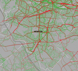
Another data source is Strava’s heatmap for Newton: https://www.strava.com/heatmap#13.18/-71.19038/42.33974/hot/ride
Obviously this data is biased to recreational riders who use the app for those rides and commuting. You can clearly see the roads that cyclists prefer to be on.
@Doug, the Strava map is interesting, but tends to bend toward the Strava audience, which is more exercise-focused than the more utility-focused Lime users. I’d be curious to see how this maps against time of day, as I know many cyclists get out early to ride those routes.
Mike & Ben,
I do believe, per my comments, my points are both correct AND borne out by the facts I cite.
While you certainly opine differently, my facts are facts.
But I’m certainly willing to leave it at that if you have no specifics countering my SPECIFIC points.
“As bike ridership percentage is so low, less than 0.03% (less than 3 in 10,000 trips)”
Not a fact, Jim.
@Doug and @Chuck, as a Strava user and excercise cyclist, I tend to agree with that- I doubt Strava shows the real utilitarian/commuter/getting around kind of cycling we really need the safety infrastructre for.
It seems we need to treat the Lime data as directional- probably a great place to point where people are most likely to bike, but likely nowhere near truth in terms of pure number of cyclists.
I’m not going to even get into the silliness of claiming that “per capita” accidents rise with bike usage, as that’s not how the math works. You measure the rise or fall as a percentage of total riders; of course the raw number of accidents may go up with the number of cyclists, but the percentage is unlikely to rise, and may in fact go down- and that only proves the need for safer bike infrastructure.
OK, I did get into it.
Google knows exactly how many bike trips are taken, how many are residents vs non-resident, frequency per resident, route patterns, times of day, likely intent of the trip, weather conditions/temps/precipitation and level of fear/heart rate of said biker. They use exactly this technology for Google Maps/Directions and Google Fit.
Ben,
I’m not talking about all bike ridership being 0.03%, I’m talking about Lime bike-type trips, which was the subject of this thread. I’m talking about bike trips which supposedly supplanted other moded trips. (I’m not talking about bike riding primarily for recreation and pleasure.)
Jim, you then continued
“And couple that with Greg’s statistics where 0.03% bike usage (3 in 10,000) reduces overall road traffic by only .12% (12 in 10,000) -Greg’s submitted 1 to 4 ratio.”.
Greg certainly wasn’t talking about “Lime” bike traffic, so these numbers aren’t facts either.
What Ben said. Bike share alone hasn’t make a big dent yet. But everything adds up. If we make it safer to bike; if we make it safer to walk; if we add shuttles )such as the free electric shuttle system Northland is ready to fund on Needham Street), then it’s possible to see how we can get a 5 percent reduction of cars off the road and reduce traffic for those who choose or need to drive by 20 percent.
Not sure how anybody can be against that.
Ben,
I was simply using Greg’s own 4 to 1 ratio, to what I said above “bike trips supplanting other moded trips” — which ratio would seemingly apply to the numbers you plug in.
Greg,
I’m not against getting cars off roads, but to say bikes are going to supplant cars or driving by 20% or 5% or reduce car traffic by those amounts is simply not realistic, whether you factor the 0.03% lime-type bike usage or whatever.
@jim to bring this full circle, you stated above that the city should not invest at all in bike lanes or other associated concepts because the percentage of users is too low. The points made after that are about proving that yes, we should invest because the impact can be much larger than what is currently happening, and that impact could have a measurable impact on our lives.
Greg’s final point brings in other factors (like buses) not point out that we can reduce the usage enough to lighten the load, all without having to make changes to our road infrastructure.
Chuck
Where we part company is over whether the expense of new bike infrastructure is in any way justified because of some small incremental increase use of bikes actually supplanting other modes of transportation to significantly reduce traffic.
It’s been proven to work around the world, including in Carmel, Indiana. Carmel is a suburban American community of roughly 90,000 people that also experiences cold and snow. Lexington and Somerville here in Mass also have seen changes thanks to bike infrastructure. I’m not sure what makes Newton so unique that it can’t possibly work here.
I know that this is another post by Burke from the past, but the truth is that we rode our bikes from one side of Newton to the other during the early 1950s, but spent as little time as possible on the major roadways. We used a network of side streets and minor thoroughfares to get from one part of the City to another. I’m not entirely certain why we opted for these “roads less traveled”, but I think it was chiefly because we found the ride safer, less hectic and far more enjoyable. I don’t recall that travel time was that much slower. The only times we veered from these backstreets was when we held weekly races on the newly opened Route 128 until they outlawed bikes on that roadway.
That said, I used many of these same routes when I returned from Washington to Newton during the late 90s. The major impediment to a cross city experience was the Mass Pike extension through Newton that displaced some of these side streets or cut them in two. I still think it would be possible to designate a set of “preferred alternate bike routes” with beefed up safety features where passage on or through a major roadway is unavoidable. I may get on a bicycle again, but there’s noway I will travel on a major or heavily used roadway.
Chuck – I am 100% Team Biking here but Carmel had a blank (and mostly flat) slate with which to work. They have had the benefit of cultivating bike paths and ridership as the city has more than doubled in population this century. Newton has had roughly the same number of residents for 75 years and our demo skews significantly older. Our topography and street layout, while beautiful and interesting, is much more challenging than their wide-open grid.
However, I give my full support to making bikes a better choice here and all over Eastern Mass. Our family members bike whenever feasible: to Fenway Park; Walgreens; the Esplanade; Bread & Circus; work; the T; school; to a friend’s house; church; wherever. I love it.
Have a great weekend.
Thanks, Bob, good thoughts.
The idea of using lesser traveled streets is a good one. In general, there’s widespread support for safer neighborhood streets. Things tend to break down on the “occasionals” (parking in front of a house for specific events or landscapers, the one or two people who want no limits to their driving, etc).
Even acknowledging those issues, the opportunities to make neighborhood streets (and the streets that connect them) safer far outstrips the resources we have available to do it. I think we could build consensus around this longstanding desire.
One thing to keep in mind, though. Busy streets are often busy because the host popular destinations, including places where people want to bike to conveniently. Newton doesn’t have a lot of long streets without residences or businesses like more suburban or exurban towns. We should try to make these destinations available safely.
We should also set an expectation that every non-limited access road is safely bikeable, even if they aren’t necessarily completely comfortable for every rider. Bikeable streets are safer streets for everyone including drivers. “Safe enough to ride your bike on” is an excellent minimum standard of livability.
Finally, some of our big streets were made big because of trolleys. Today, they may have excess width that can be repurposed for safer bike and pedestrian facilities. That really benefits everyone who lives here, at the possible (and I say possible, because it isn’t always true by any means) inconvenience of some people passing through at some times of day.
Newton’s early stages of bike accommodation have primarily been opportunistic: making changes when paving is happening. This stage is common and useful. Our next step is to be strategic: making the connections that you and your friends informally made back in the day.
For example, I think of Nevada/Anthony/Farwell up north here, which would bring people from North Street all the way to Nonantum (including connections to the river and Calvary Cemetery, which connects to the top of Cherry Street). Could that be a “slow route”, suitable for casual biking and safe walking as well as careful driving? That’s exactly the kind of route kids have likely ridden for years.
Mike,
Excellent points about side streets. Back when younger and a regular bike ride, I always sought out side streets wherever possible, especially traveling north from the Highlands. I had routes going north to the Charles River paths in Nonantum. And the main east and west was the Comm Ave carriage path whenever possible, NEVER the main driving part (have always wondered WHY the painting/creating bike lanes in Comm Ave’s busy main thoroughfare directing bikers to use those less safe lanes instead).
FWIW Needham just released a consultant study on pedestrian safety which it commissioned after the deaths of two girls in a crosswalk behind the high school in 2018.
The recommendations include the creation of five 20-mph ‘safety zones’ with lengths of between 1/4 mile and 1/2 mile, each with 3-4 ft. wide bike lanes painted green.
https://www.needhamma.gov/DocumentCenter/View/20316/2019-10-31_FinalPedAudit
I lived in Carmel for three months about five years ago. While the city is remarkable for its progressive street, streetscape, and civic place-making design, its bike accommodations were more geared to recreation and not transportation. They are also not next to highly walkable cities like Boston and Cambridge. They continue to improve and innovate, though. Attitude and perseverance is a big deal.
Indianapolis, however, has unbelievable bike and pedestrian accommodations fit right into an existing urban core. The Indianapolis Cultural Trail connects everything. It features public art. It looks spectacular. It’s heavily used. It’s embraced by the community. If you’re in the area, it’s a must see.
Click through these pictures:
https://www.visitindy.com/indianapolis-cultural-trail
https://www.visitindy.com/indianapolis-canal-walk
More info:
https://indyculturaltrail.org/
An avid cyclist, what has kept me safe is being a hyper-vigilant, communicative, confident rider. That said, if Newton wants more substantial bike infrastructure I can support it – But we desperately need to be having a different conversation than what has transpired here on V14.
Painted bike lanes – like what is now at the end of Waltham Street – is not enough to protect riders and can be more dangerous than riding a bike on a major street with no bike infrastructure.
People are far safer and far more likely to ride if we build bike lanes with physical barriers – Bike lanes that are raised from the roadway are the safest. Studies show that drivers pass cyclists 1.25 feet closer when they’re in painted bike lanes compared to streets with no bike infrastructure.
Not all protected bike lanes are the same
https://www.iihs.org/topics/bibliography/ref/2193
Bike lanes need barriers, not just paint
https://www.curbed.com/word-on-the-street/2019/5/10/18527503/bike-lanes-red-cup-project
I can def support developing bike (and pedestrian) infrastructure on its own merits, but I think it’s damn foolish to consider bike ridership as a significant factor in reducing congestion and taking better care of our planet here in Newton MA. As @Greg said, every little bit helps – And I agree with him, but I’m not convinced that walk-bike ability can be used as a significant variable that we use to build our zoning on.
Adding upon Mike Ciolino’s last comment, the issue boils down to a justification for the City of Newton to fund “more substantial bike infrastructure” (more than just “painted bike lanes”). For the purpose of this analysis, I’ll divide Mike’s statement on this into two parts: (1) that he “supports developing such bike infrastructure on its own merits” but (2) that “it’s damn foolish to consider bike ridership as a significant factor in reducing congestion and taking better care of our planet here in Newton.”
I agree with Mike’s second part, but not the first part. That is, I more than wholly agree, as I have reiterated throughout this thread, that bike ridership as a significant factor in reducing congestion, etc., is, as Mike says, “damn foolish”. This leaves us with the first part, and that is WHERE I TAKE ISSUE with Mike, that absent the “foolish” conclusion that traffic will actually in any significantly way be reduced — that is, simply funding bike infrastructure (without considering its supplanting traffic) — is insufficient to justify what it would cost for the “more substantial bike infrastructure”, as called for say by Greg and others, especially when there are such higher priorities as regards repair and maintenance of streets in Newton, or other traffic enhancing street improvements.
So in future discussion on whether to fund substantial bike infrastructure, I’d merely say don’t predicate it on the false notion that biking is going to supplant other modes of travel so as to significantly reduce traffic congestion, but predicate it solely on its own merits (say for health and recreation) — and that’s where I say there’s insufficient justification for expenditure thereon.
There was an interesting article in today’s NYT about biking in Copenhagen.
I have biked in Copenhagen. It’s very different from Newton, or most American suburbs. The cars are tiny. No one wears helmets. The bikes are clunkers. No one has those goofy drop handlebars. Women’s in skirts have ” girls bikes” which make it easy to get off. People have their kids sitting on the handlebars as they go about their business, it’s really dense, the housing is packed together. They also have real reliable public transit. Trolleys above ground.
It’s a very different vibe. I don’t think there is anywhere in the US like it.
I can see doing something like closing off back bay areas or south end areas to ALL traffic except service vehicles. That would force all the residents to change their mode. The other thing to do is to tax gas so it’s 6.00 a gallon, creating demand for those tiny little cars.
But really, unless you’ve been there, it’s hard to understand just how different it is from a broad suburb like Newton.
Just so I understand @Jim’s position, we should only invest in road infrastructure if it accommodates cars. This means, if you want to visit someone in Newton or live in Newton, you must use a car.
So if you cannot drive, possibly because you’re under the age of 16 or maybe because you’re disabled in a way that prevents it, or you’re not able to afford the additional cost of vehicle ownership, or you’re a local young adult whose parents can’t afford to buy an additional vehicle, or you’ve chosen to reduce your car use, then you’re not welcome on our roadways or in our city.
Chuck,
That’s absolutely not what I said.
I said if there is to be funding for substantial bike infrastructure, it should NOT be “based on bike ridership as a significant factor in reducing congestion and taking better care of our planet here in Newton” (since it is not a significant factor); and when you eliminate that factor, there is insufficient basis for heavy investment entailed in substantial bike infrastructure.
Chuck,
I’d say there is no difference between that position and your observation of the de facto result, acknowledged or not.
Fortunately, the evidence appears to suggest something much closer to your position is representative of Newton as a whole, both judging from the public meetings I’ve attended at the West Newton Square, Walnut Street, and Washington Street projects, and based on several election results.
Ben & Chuck,
I’d agree with you that up until now, Newton has likely been in favor of heavier investment in more substantial bike infrastructure. But biking has been presented as a means to significantly reduce motor vehicle traffic congestion on its roads (as well as to combat climate change), which as avid cyclist Mike C. correctly points out above, that’s a “damn foolish” premise.
If heavier investment in more substantial bike infrastructure (beyond painting bike lanes where there’s space) is fairly to be presented to City Council and/or voters, it needs to stand on its own merits, including for recreation and health, not on the false premise that it will significantly reduce traffic. And I believe that such fairer presentation will mitigate in favor of directing those funds to repair and maintenance of Newton’s existing (third world status) roads along with traffic and safety enhancement infrastructure.
Just one footnote to my earlier post about bicycling here in the early 1950s. One thing I didn’t note was how much we biked on the two aqueducts. In essence, this meant that we could completely bypass the village centers and most heavily used roadways in Lower Falls, Waban, the Highlands, Newton Center and Upper Falls, and that we could connect to both Wellesley and Needham. That’s a big chunk of the City. I still walk these aqueducts, but only rarely do I see anyone on a bicycle. Maybe there are opportunities here to share the aqueduct among various users.
Bob,
As the MWRA owns the aqueducts (not the City of Newton), ask them to pave bike paths. As they are now, you’d probably do best with a dirt bike or hybrid (but not a racer).
I happen to back up on one, and would have no problem with a bike path.
(BTW, it’s currently great for human and dog walking.)
My wife reminded me that I biked in Amsterdam, not Copenhagen.
But I’m sure it’s similar. The vibe on the street was very different than the Newton. People didn’t bike fast, sometime someone was sitting casually on the back hitching a ride- I didn’t see much in the way of fancy trailers like in the NYT article. People had their little kids in snugglies carrying them, people were carrying a bag of groceries, no helmets, and….smoking cigarettes. They also smoked other substances but only in the coffee shops. And as I mentioned, no fancy bikes, or very few. They have working canals too. I saw a dhl delivery boat. I suspect our coastal cities will have canals in the future as a ay to deal with rising oceans. Using the canals for transportation makes sense as well.
The Lime experiment was a failure. Don’t care if the next is Blue (orange or pink).
New England’s weather is not bike friendly for 1/2 of the year if not more.
With all the transportation options afforded by modern technology – from fuel efficient, hybrid and pure electric cars, to ride sharing apps – asking people to adopt the bike as their primary mode of transport is like asking them to ONLY MAKE CALLS WITH A ROTARY PHONE!
I get it, bikes are better for the environment. But there are SO FEW PRACTICAL USE CASES that makes biking remotely attractive, yet there are a few of you that continue to push this topic. It’s like trying to push a square peg into a round hole!
Improving the environment and climate require revolutionary ideas, beyond just bikes…
Improvement of battery technology so housed can be 100% self sufficient via solar. Imagine if NO fossil fuels are needed to produce electricity?
Having as many electric (car) charging stations as gas station. Refueling scarcity is one of the leading consumer barriers to going full electric.
Zone for more commercial office space in Newton and Needham. Or create “business hubs” in Newton where people can, “work from home” in a Newton sponsored (in partnership with Developers?) “We Work” like shared working spaces. Don’t know the % of Newton residents who work in Boston, but I bet it’s pretty high.
Putting all of our eggs in an a 19th century basket (bikes) has a low probability of success.
Your argument reeks of privilege Matt.
Not one person has argued your strawman of making biking the primary mode of transportation.
How about you actually read the comments made and contribute something useful other then trolling? It’s tiresome and doesn’t contribute to the discussion at all.
https://www.thediscourse.ca/wp-content/uploads/2016/11/infographic_2_subsidy_v03.webp
Often forgotten in this discussion is the externalities of transportation and its costs to society.
If driving costs you $1, society pays $9.20 vs $0.08 if you bike ($0.01 if you walk). It’s time to push back against this. Widening streets and adding more vehicle lanes induces demand.
Also, some people lament ADA compliance, but there is collateral benefit in that it makes it easier for ABLE bodied folks to also get around (plus those with strollers, delivery people with dollies, etc). The same can be said of increased biking like what Greg was saying – a reduction of just 5% can have an amplifying effect and make driving more efficient with less congestion. Widening sidewalks for pedestrian and biking and decreasing roadway acreage makes it easier to clear snow (you have someplace on the walkway to dump it) and make a path wide enough for walking during snowy weather than the tiny narrow paths which are treacherous when icy.
We pay so much in snow plowing streets – how much do we pay for sidewalk clearing, if any?
@Nelson (anonymous)…
Pile on if you’d like, but the facts remains that people do not bike in Newton (other than recreationally). If it’s not a weekend day, you can count the number of bikers seen on a given week on one hand. Less now that temps begin to drop as Old Man Winter nears.
Wish it wasn’t this way, and biking is a viable primary mode of transport but this is New England, not San Diego. Square peg, meet round hole.
And as for your “privilege” remark, I shovel our driveway and sidewalks. You can also find my butt any Mon-Fri at the Eliot T stop for my commute into Boston. Just a regular dude getting thru life. No McMansion. No Bentleys in the driveway.
Have I thought of biking in during warmer weather? Sure. But who wants to roll into a meeting a sweaty mess?
@matt I’ve been on the roads in winter on a bike, and I see plenty of others. Even when it snows, take a look at both Newton North and at Newton South and you see plenty of bikes.
Adults bike too. My son just took a job in Cambridge and bikes the 4 miles every day. He has cold weather gear. I see it in Somerville in Feburary when the afternoon commute includes lines and lines of cyclists. Biking doesn’t mean taking a 10 mile ride into Boston, it could mean filling in blanks between locations. It could mean driving to a point that keeps you out of a congestion zone to bike the rest of the way (Park and Pedal spots are in your neighborhood too). MBTA buses have bike racks on them to allow people to combine modes.
As for your suggestions about co-working in Newton, you are correct that we have the demand-side of the equation, but there are a lot of reasons why it hasn’t taken off here, one of the key issues is transportation. (I spent the last 3 years trying to coax co-working to Newton and Needham, speaking with companies, leading report on the topic and working with developers. In fact, Northland has spoken with co-working companies for parts of its project… the one you’re trying to make smaller).
A co-working location is only viable when it’s done at a density that is almost 2x a standard office building, meaning you need a way to get people there. Co-working companies also value locations with walkability, including dining and entertainment. If you put in enough parking to accommodate that kind of density, you lose walkability. Which means, to answer the co-working conundrum, we need transportation alternatives.
Another barrier to walk-ability is the unfortunate trend of externalizing the cost of consolidation. Now, instead of walking to the old office supply store in West Newton, I have to drive to Staples. Instead of walking to Harney Hardware in West Newton, I have to drive to Home Depot where I have the pleasure of checking my own items out in the self service lane. What retail will go into Washington place? Well a bank, I know. A small hardware store? I’m surprised that Swartz Hardware has stayed afloat. The Barn? That’s good, I hope they can continue to afford it. I had a friend who tried to convince me to Drive to Costco to save 30 cents on a can of tennis balls. People used to wait in long lines at Sunoco to save 10 cents a gallon on Mondays, what did they save? 1.70? Anyways, other than for recreation I’ve got few places to bike to.
(Can we get logins for commenting? No idea, don’t see place for registering anywhere)
When I lived in Allston-Brighton, I used to take the Green Line into work near the Cambridgeside Galleria and it would take me approximately 1 hour to get into work.
For an added 30 minutes and a good workout, I would walk, taking Comm Ave, walk over the bridge near the BU GSU, and then the walkway which runs along the Charles River/Storrow Drive. I would do this even in the winter time, when the walkway was plowed but would ice over from snow melt.
This was a privilege afforded to me because my job was flexible – could start later if I wanted to, and I could work from home as well.
Speaking of Comm Ave, they FINALLY have protected bike lanes. Last year there must have been about five bike deaths in that area. I’ve also biked on Comm Ave to commute and there would be a pile-up of about 10 bikes, some commuters, some students – at each red light, which goes to show you the high volume of bikers that area gets.
My brother also biked from Cambridge into the heart of the Boston Financial District.
We should make it easier to bike for routes to Newton North and South for students (as evidenced by the plethora of bikes locked at these schools). When weather’s bad, maybe they can take their electric cars ;
Also, as anyone driving during rush hour can attest, biking is often faster than driving due to traffic congestion. I have young son who goes to preschool, and taking Centre St is the most direct route, but I feel it’s just too dangerous to take him on an unprotected pathway with my bike and trailer, and I speak as a someone who had *no fear* about taking the middle of the lane with vehicles.
Rick Frank,
Instead of driving to such stores as Staples, Home Depot etc., shop and buy online.
In fact, the growth of the Amazons’ and online shopping is the single biggest traffic reducer!
If everyone in Newton made a concerted effort in this regard, this will have a very positive effect on traffic congestion.
I even see online schooling reducing the need for transportation of students as well as many of the resource consuming public school buildings down the road (which also could free up control by the teachers unions and left wing indoctrinators). See e.g., https://www.k12.com/virtual-school-offerings/online-public-schools.html
Jim’s statement about online shopping reducing traffic congestion seems to be inaccurate and getting worse. The luxury of overnight or same-day delivery has now become the expectation for many people. The economy of scale is being lost because trucks are now making multiple trips to every neighborhood throughout the day, often from different services:
https://www.curbed.com/2019/1/10/18177399/amazon-delivery-traffic-online-shopping-e-commerce
https://www.nytimes.com/2019/10/27/nyregion/nyc-amazon-delivery.html
To address Rick Frank’s point, Newton’s future denser developments will offer an ideal opportunity to bring destinations that need convenience within easy bikeable and walkable distances. That means restaurants, convenience stores, package delivery stores, markets, my dream catch-all store like mini-Target, etc. Put people within the same complex, or within 0.1-0.2 miles, and many will walk. Put them within 0.5-1 mile, and give them a safe path, and you’ll see a good number bike when the weather is good. Enough people in that radius, and you’ll see bike delivery like is common in NYC. Even considering car trips, the car trips will be shorter and not clog major thoroughfares.
The numbers of people may not be huge, but on the other hand these are the trips that are worrying neighbors near these developments. This is also the kind of local, neighborhood shopping that builds stable clientele and a sense of community.
Mike, you’re right. On further reflection I should have said reducing the problem of traffic congestion for the on-line shopper (not having to drive in that congestion to shop).
The Boston Globe Spotlight team has a good three part series on traffic congestion covering the politics, employer incentives, and technology (delivery vehicles, ride hailing, autonomous vehicles)
https://apps.bostonglobe.com/metro/investigations/spotlight/2019/11/19/seeing-red//boston-traffic-stuck-politics
https://apps.bostonglobe.com/metro/investigations/spotlight/2019/11/20/seeing-red/employer-incentives-make-traffic-worse/
https://apps.bostonglobe.com/metro/investigations/spotlight/2019/11/21/seeing-red/convenience-culture-makes-traffic-worse
Whoops, looks like Greg beat me to it – great minds think alike…
https://village14.com/2019/11/20/whats-your-transportation-big-idea/
Thanks for posting Nelson!
Didn’t get to finish reading before reaching the office (yes, I am on the T – Green Line), but loved the focus on State leaders and walking saying one thing, but the do another (driving). The hypocrisy of politics.
Will finish these articles later.